
Suitability Mapping for Subsurface Floodwater Storage Schemes
DOI:
https://doi.org/10.69631/ipj.v1i2nr20Keywords:
Flood and drought management, Managed aquifer recharge (MAR), Geographic information systems (GIS), GIS-based multi-criteria decision analysis (GIS-MCDA), Floodwater storage, Landscape water balanceAbstract
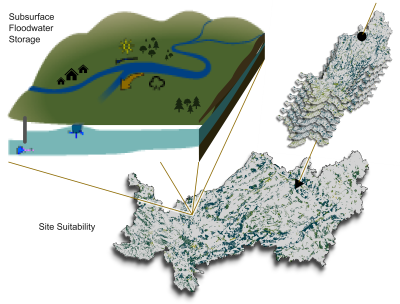
The hydrological conditions a changing climate imposes require updated measures to address extreme water events sustainably. These must evolve from isolated solutions, such as water retention basins, to holistic management strategies that consider at least two situations simultaneously, such as floods and droughts. One strategy for sustainable groundwater management is managed aquifer recharge (MAR), which copes with decreasing groundwater levels by a targeted recharge of aquifers. Using high water as a recharge water source (Flood-MAR) can additionally cover the aspect of flood protection, resulting in a multi-beneficial solution for the region. This study evaluated the site suitability for subsurface floodwater storage schemes, which must focus more on assessing the existing aquifer characteristics and the specific flood dynamics in nearby rivers compared to known MAR schemes. Potential sites for underground flood storage are characterized by decreasing groundwater levels and, thus, frequent water scarcity, combined with eminent risks of flooding by a nearby river. Suitability, on the other hand, must take the aquifer, surface, and water source characteristics into account. In this study, we present a workflow for generating suitability maps for implementing subsurface floodwater storage systems with a geographic information system-based multi-criteria decision analysis (MCDA). The workflow was intentionally and exclusively based on publicly available data, was implemented in Python, and provided as open-source software. The resulting suitability maps spatially depict the feasibility of underground flood storage, and thus form the basis for the implementation planning of such projects. The approach was demonstrated for the administrative district of Swabia, Germany, where approximately 35% of the area was identified as suitable at varying levels. A sensitivity analysis of the assigned weights was applied to show the high robustness of the underlying data. The results highlighted the enormous potential of implementing such sustainable co-management schemes, which needs to be further concretized by on-site observations.
Downloads
References
Alam, M., F., Pavelic, P. 2020. Underground Transfer of Floods for Irrigation (UTFI): exploring potential at the global scale. Colombo, Sri Lanka: International Water Management Institute (IWMI). 58p. (IWMI Research Report 176). https://doi.org/10.5337/2020.204 DOI: https://doi.org/10.5337/2020.204
Aloui, D., Chekirbane, A., Stefan, C., Schlick, R., Msaddek, M. H., & Mlayah, A. (2022). Use of a GIS- multi-criteria decision analysis and web-based decision support tools for mapping and sharing managed aquifer recharge feasibility in Enfidha plain, NE of Tunisia. Arabian Journal of Geosciences, 15(7). https://doi.org/10.1007/s12517-022-09893-8 DOI: https://doi.org/10.1007/s12517-022-09893-8
Anane, M., Kallali, H., Jellali, S., & Ouessar, M. (2008). Ranking suitable sites for Soil Aquifer Treatment in Jerba Island (Tunisia) using remote sensing, GIS and AHP-multicriteria decision analysis. International Journal of Water, 4(1-2), 121-135. https://doi.org/10.1504/IJW.2008.018151 DOI: https://doi.org/10.1504/IJW.2008.018151
Aurenhammer, F. (1991). Voronoi diagrams: A survey of a fundamental geometric data structure. ACM Computing Surveys, 23(3), 345–405. https://doi.org/10.1145/116873.116880 DOI: https://doi.org/10.1145/116873.116880
Bayerische Vermessungsverwaltung [Bavarian Surveying Administration]. (2022a). OpenData: ALKIS®-Tatsächliche Nutzung (TN) Actual Usage]. Retrieved October 31, 2023, from https://geodaten.bayern.de/opengeodata/OpenDataDetail.html?pn=tatsaechlichenutzung
Bayerische Vermessungsverwaltung [Bavarian Surveying Administration]. (2022b). OpenData: Digitales Geländemodell 1m (DGM1) [Digital Terrain Model]. Retrieved October 31, 2023, from https://geodaten.bayern.de/opengeodata/OpenDataDetail.html?pn=dgm1
Bayerisches Geologisches Landesamt [Bavarian Geological State Office]. (1996). Erläuterungen zur Geologischen Karte von Bayern 1:500000 [Explanations to the geological map of Bavaria]. Retrieved December 5, 2023, from https://www.bestellen.bayern.de/application/eshop_app000006?SID=1196519977&ACTIONxSETVAL(artdtl_geo.htmAARTxNODENR:203256,USERxBACKNR=203261)=Z
Bayerisches Landesamt für Umwelt [Bavarian State Office for the Environment]. (2009). Geologie und Böden in Schwaben [Geology and soils in Swabia]. Retrieved February 23, 2023, from https://www.bestellen.bayern.de/application/applstarter?APPL=eshop&DIR=eshop&ACTIONxSETVAL(artdtl.htm,APGxNODENR:203258,AARTxNR:lfu_bod_00058,AARTxNODENR:193937,USERxBODYURL:artdtl.htm,KATALOG:StMUG,AKATxNAME:StMUG,ALLE:x)=X
Bayerisches Landesamt für Umwelt [Bavarian State Office for the Environment]. (2018). Mittlerer jährlicher Niederschlag in Bayern 1981-2010 [Mean annual rainfall in Bavaria]. Retrieved February 24, 2023, from https://www.bestellen.bayern.de/application/applstarter?APPL=eshop&DIR=eshop&ACTIONxSETVAL(artdtl.htm,APGxNODENR:4016,AARTxNR:lfu_was_00138,AARTxNODENR:352970,USERxBODYURL:artdtl.htm,KATALOG:StMUG,AKATxNAME:StMUG,ALLE:x)=X
Bayerisches Landesamt für Umwelt [Bavarian State Office for the Environment]. (2021). Niedrigwasser 2018 und 2019: Analysen und Auswirkungen für Bayern [Low water in 2018 and 2019: analyzes and effects for Bavaria]. Retrieved April 11, 2022, from https://www.bestellen.bayern.de/application/applstarter?APPL=eshop&DIR=eshop&ACTIONxSETVAL(artdtl.htm,APGxNODENR:3771,AARTxNR:lfu_was_00198,AARTxNODENR:357889,USERxBODYURL:artdtl.htm,KATALOG:StMUG,AKATxNAME:StMUG,ALLE:x)=X
Bayerisches Landesamt für Umwelt [Bavarian State Office for the Environment]. (2021a). Entwicklung der Grundwassersituation in Bayern [Development of the groundwater situation in Bavaria]. Retrieved February 26, 2023, from www.lfu.bayern.de/wasser/grundwassersituation_bayern/index.htm
Bayerisches Landesamt für Umwelt [Bavarian State Office for the Environment]. (2021b). Hydrogeologische Karte 1:100000 [Hydrogeological map]. Retrieved November 2, 2023, from https://www.lfu.bayern.de/geologie/hydrogeologie_karten_daten/hk100/index.htm
Bayerisches Landesamt für Umwelt [Bavarian State Office for the Environment]. (2023a). Bayerisches Klimainformationssystem (BayKIS) [Bavarian climate information system]. Retrieved October 16, 2023, from https://klimainformationssystem.bayern.de
Bayerisches Landesamt für Umwelt [Bavarian State Office for the Environment]. (2023b). Gewässerkundlicher Dienst Bayern [Water Science Service Bavaria]. www.gkd.bayern.de
Bayerisches Landesamt für Umwelt [Bavarian State Office for the Environment]. (2023c). Hochwassernachrichtendienst Bayern [Bavarian Flood Intelligence Service]. www.hnd.bayern.de
Bayerisches Landesamt für Umwelt. (2023d). UmweltAtlas Bayern [Environmental Atlas of Bavaria]. www.umweltatlas.bayern.de
Bonfanti, M. E., & Capone, F. (2014). A preliminary assessment of the normative framework regulating MAR schemes in Europe: The EU directives and their implementation in nine national legislations. Acque Sotterranee - Italian Journal of Groundwater, 3(3), 61–66. https://doi.org/10.7343/AS-084-14-0111 DOI: https://doi.org/10.7343/as-084-14-0111
Bundesrepublik Deutschland [Federal Republic of Germany]. (2009, July 29). Gesetz über Naturschutz und Landschaftspflege: Bundesnaturschutzgesetz – BnatSchG [Law on Nature Conservation and Landscape Management: Federal Nature Conservation Act] (BGBl. I p. 2542) [Last amended by Article 3 of the Law of December 8, 2022 (BGBl.I p. 2240)]. https://www.gesetze-im-internet.de/bnatschg_2009/BJNR254210009.html
Caswell, T. A., Droettboom, M., Lee, A., Sales de Andrade, E., Hoffmann, T., et al. (2022). Matplotlib (Version 3.5.2). Zenodo. https://doi.org/10.5281/zenodo.6513224
Chen, Y., Yu, J., & Khan, S. (2010). Spatial sensitivity analysis of multi-criteria weights in GIS-based land suitability evaluation. Environmental Modelling & Software, 25(12), 1582–1591. https://doi.org/10.1016/j.envsoft.2010.06.001 DOI: https://doi.org/10.1016/j.envsoft.2010.06.001
Council of the European Union. (2000). Directive 2000/60/EC of the European Parliament and of the Council of 23 October 2000 establishing a framework for community action in the field of water policy: Water Framework Directive. https://eur-lex.europa.eu/legal-content/EN/TXT/?uri=CELEX%3A02000L0060-20141120
Crameri, F. (2023). Scientific colour maps (Version 8.0.1). Zenodo. https://doi.org/10.5281/zenodo.8409685
Dillon, P., Pavelic, P., Page, D., Beringen, H., & Ward, J. (2009). Managed Aquifer Recharge: An Introduction. Waterlines Report Series No. 1, February 2009. Australian Government National Water Commission. ISSN: 978-1-921107-71-9. https://recharge.iah.org/files/2016/11/MAR_Intro-Waterlines-2009.pdf
Dillon, P., Stuyfzand, P., Grischek, T., Lluria, M., Pyne, R. D. G., et al. (2019). Sixty years of global progress in managed aquifer recharge. Hydrogeology Journal, 27(1), 1–30. https://doi.org/10.1007/s10040-018-1841-z DOI: https://doi.org/10.1007/s10040-018-1841-z
Dudley, N. (Ed.). (2008). Guidelines for applying protected area management categories. IUCN. https://portals.iucn.org/library/sites/library/files/documents/pag-021.pdf DOI: https://doi.org/10.2305/IUCN.CH.2008.PAPS.2.en
Eastman, J. R. (1997). IDRISI for windows, version 2.0: Tutorial exercises. Graduate School of Geography, Clark University.
European Commission, Directorate-General for the Environment, Mézard, N., Sundseth, K., & Wegefelt, S. (2008). Natura 2000: Protecting Europe’s biodiversity (S. Wegefelt, Ed.). https://doi.org/10.2779/45963
European Commission – Eurostat/ GISCO. (2021). Administrative boundaries: NUTS (nomenclature of territorial units for statistics). Retrieved December 11, 2023, from https://ec.europa.eu/eurostat/web/gisco/geodata/reference-data/administrative-units-statistical-units/nuts
European Environment Agency. (2020). EU-Hydro River Network Database 2006-2012 (vector), Europe - version 1.3. https://doi.org/10.2909/393359a7-7ebd-4a52-80ac-1a18d5f3db9c
Fernández Escalante, E., Henao Casas, J. D., Vidal Medeiros, A. M., & San Sebastián Sauto, J. (2020). Regulations and guidelines on water quality requirements for managed aquifer recharge: International comparison. Acque Sotterranee - Italian Journal of Groundwater, 9(2), 7–22. https://doi.org/10.7343/as-2020-462 DOI: https://doi.org/10.7343/as-2020-462
Flood-MAR Research Advisory Committee. (2019). Flood-MAR Research and Data Development Plan: Priority Actions to Expand Implementation of Effective and Efficient Flood-MAR Projects in California. https://water.ca.gov/-/media/DWR-Website/Web-Pages/Programs/Flood-Management/Flood-MAR/Flood-MAR-RDD-Plan_a_y_19.pdf
Gillies, S., van der Wel, C., Van den Bossche, J., Taves, M. W., Arnott, J., et al. (2023). Shapely (Version 2.0.1). Zenodo. https://doi.org/10.5281/ZENODO.7583915
Gommers, R., Virtanen, P., Burovski, E., Weckesser, W., Oliphant, et al. (2022). SciPy (Version 1.8.0). Zenodo. https://doi.org/10.5281/ZENODO.5979747
Hashemi, H. (2015). Climate change and the future of water management in Iran. Middle East Critique, 24(3), 307–323. https://doi.org/10.1080/19436149.2015.1046706 DOI: https://doi.org/10.1080/19436149.2015.1046706
Hussaini, M. S., Farahmand, A., Shrestha, S., Neupane, S., & Abrunhosa, M. (2021). Site selection for managed aquifer recharge in the city of Kabul, Afghanistan, using a multi-criteria decision analysis and geographic information system. Hydrogeology Journal, 30(1), 59–78. https://doi.org/10.1007/s10040-021-02408-x DOI: https://doi.org/10.1007/s10040-021-02408-x
IGRAC. (2020). MAR Portal. Retrieved October 11, 2022, from https://ggis.un-igrac.org/view/marportal
International Organization for Standardization (ISO). (2017). ISO 14688-1:2017 Geotechnical investigation and testing - Identification and classification of soil - Part 1: Identification and description. https://www.iso.org/standard/66345.html
IPCC. (2023). Climate change 2022: Impacts, adaptation and vulnerability: Contribution of working group II to the sixth assessment report of the intergovernmental panel on climate change (H.-O. Pörtner, D. C. Roberts, H. Adams, C. Adler, P. Aldunce, E. Ali, R. A. Begum, R. Betts, R. B. Kerr, & R. Biesbroek, Eds.). https://doi.org/10.1017/9781009325844 DOI: https://doi.org/10.1017/9781009325844
Jordahl, K., Van den Bossche, J., Fleischmann, M., McBride, J., Wasserman, et al. (2022). GeoPandas (Version 0.12.2). Zenodo. https://doi.org/10.5281/zenodo.7422493
Kreibich, H., & Thieken, A. H. (2008). Assessment of damage caused by high groundwater inundation. Water Resources Research, 44(9). https://doi.org/10.1029/2007WR006621 DOI: https://doi.org/10.1029/2007WR006621
Levintal, E., Kniffin, M. L., Ganot, Y., Marwaha, N., Murphy, N. P., & Dahlke, H. E. (2023). Agricultural managed aquifer recharge (Ag-MAR) – a method for sustainable groundwater management: A review. Critical Reviews in Environmental Science and Technology, 53(3), 291–314. https://doi.org/10.1080/10643389.2022.2050160 DOI: https://doi.org/10.1080/10643389.2022.2050160
Leyer, I. (2005). Predicting plant species’ responses to river regulation: The role of water level fluctuations. Journal of Applied Ecology, 42(2), 239–250. https://doi.org/10.1111/j.1365-2664.2005.01009.x DOI: https://doi.org/10.1111/j.1365-2664.2005.01009.x
Malczewski, J. (2000). On the use of weighted linear combination method in GIS: Common and best practice approaches. Transactions in GIS, 4(1), 5–22. https://doi.org/10.1111/1467-9671.00035 DOI: https://doi.org/10.1111/1467-9671.00035
Malczewski, J., & Rinner, C. (2015). Multicriteria decision analysis in geographic information science. Springer. https://doi.org/10.1007/978-3-540-74757-4 DOI: https://doi.org/10.1007/978-3-540-74757-4
Marr, J., Arrate, D., Maendly, R., Dhillon, D., & Stygar, S. (2018). Flood-MAR: Using flood water for managed aquifer recharge to support sustainable water resources [White Paper]. https://water.ca.gov/-/media/DWR-Website/Web-Pages/Programs/Flood-Management/Flood-MAR/DWR_FloodMAR-White-Paper_a_y20.pdf
Meschede, M., & Warr, L. N. (2019). The geology of Germany: A process-oriented approach. Springer. https://doi.org/10.1007/978-3-319-76102-2 DOI: https://doi.org/10.1007/978-3-319-76102-2
Mostafaei, A., Kalantari, N., & Zarkesh, M. K. (2016). Assessing the success of floodwater spreading projects using a fuzzy approach. Water Science and Technology, 74(8), 1980–1991. https://doi.org/10.2166/wst.2016.394 DOI: https://doi.org/10.2166/wst.2016.394
Pavelic, P., Brindha, K., Amarnath, G., Eriyagama, N., Muthuwatta, L., et al. (2015). Controlling floods and droughts through underground storage: From concept to pilot implementation in the Ganges River Basin [IWMI Research Report 165]. International Water Management Institute (IWMI). https://doi.org/10.5337/2016.200 DOI: https://doi.org/10.5337/2016.200
Pavelic, P., Sikka, A., Alam, M. F., Sharma, B. R., Mutuwatte, L., et al. (2021). Case study 15: Recharging floodwaters to depleted aquifers for irrigation in the Ganges Basin, India. In Y. Zheng, A. Ross, K. G. Villholth, & P. Dillon (Eds.), Managing aquifer recharge. UNESCO.
Pedrero, F., Albuquerque, A., Marecos do Monte, H., Cavaleiro, V., & Alarcón, J. J. (2011). Application of GIS-based multi-criteria analysis for site selection of aquifer recharge with reclaimed water. Resources, Conservation and Recycling, 56(1), 105–116. https://doi.org/10.1016/j.resconrec.2011.08.003 DOI: https://doi.org/10.1016/j.resconrec.2011.08.003
Rahman, M. A., Rusteberg, B., Gogu, R. C., Lobo Ferreira, J. P., & Sauter, M. (2012). A new spatial multi- criteria decision support tool for site selection for implementation of managed aquifer recharge. Journal of Environmental Management, 99, 61–75. https://doi.org/10.1016/j.jenvman.2012.01.003 DOI: https://doi.org/10.1016/j.jenvman.2012.01.003
Ritzi, R. W., Huang, L., Ramanathan, R., & Allen–King, R. M. (2013). Horizontal spatial correlation of hydraulic and reactive transport parameters as related to hierarchical sedimentary architecture at the borden research site. Water Resources Research, 49(4), 1901–1913. https://doi.org/10.1002/wrcr.20165 DOI: https://doi.org/10.1002/wrcr.20165
Rouault, E., Warmerdam, F., Schwehr, K., Kiselev, A., Butler, H., et al. (2023). GDAL (Version 3.7.2). Zenodo. https://doi.org/10.5281/ZENODO.8340595
Saaty, T. L. (1980). The analytic hierarchy process: Planning, priority setting, resource allocation. McGraw- Hill. DOI: https://doi.org/10.21236/ADA214804
Sallwey, J., Bonilla Valverde, J. P., Vásquez López, F., Junghanns, R., & Stefan, C. (2019). Suitability maps for managed aquifer recharge: A review of multi-criteria decision analysis studies. Environmental Reviews, 27(2), 138–150. https://doi.org/10.1139/er-2018-0069 DOI: https://doi.org/10.1139/er-2018-0069
Downloads
Additional Files
Published
Issue
Section
License
Copyright (c) 2024 Lea Augustin, Thomas Baumann

This work is licensed under a Creative Commons Attribution-NonCommercial-NoDerivatives 4.0 International License.
This article is published under the Creative Commons license indicated above. See the license link for details.
Article metadata are available under the CCo license.
How to Cite
Funding data
-
Bundesministerium für Bildung und Forschung
Grant numbers 02WEE1630A